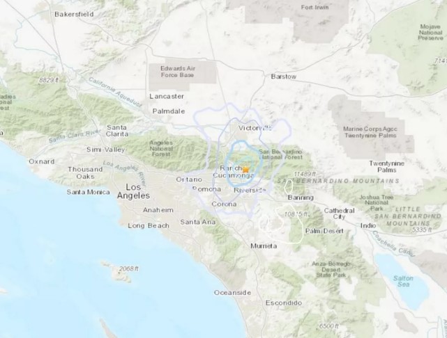
Over the past few days, California has experienced a series of earthquakes, sparking fears of a larger seismic event along the San Andreas Fault. The United States Geological Survey (USGS) recently released a map showing the extent of the shockwaves across the region.
The most recent earthquake, a 4.5 magnitude tremor, struck off the coast near Petrolia around 8:30 PM on Tuesday. The quake was reported by 168 people, with two aftershocks also recorded. These tremors add to the growing number of recent earthquakes, raising concerns among experts about increased seismic activity. Earlier, a 2.6 magnitude quake was recorded 28 km southwest of Los Banos.
Series of Earthquakes in San Bernardino
The earthquakes began early Monday morning when a 3.5 magnitude earthquake hit at 9:44 AM. Shortly after, a 3.0 magnitude aftershock followed. According to USGS, the main earthquake occurred 4.6 miles deep along the San Andreas Fault. Experts from CalTech confirmed that the second tremor was an aftershock.
The Southern California Seismic Network (SCSN) warned that aftershocks are likely in the coming days. The strongest expected aftershock would likely be one magnitude unit smaller than the original quake. While no significant damage has been reported so far, the SCSN stated that there is a 5% chance of a larger earthquake occurring, though the risk decreases over time. The shaking from Monday’s quakes was felt in San Bernardino, Riverside, Victorville, and Hesperia.
California’s High-Risk Fault Lines
San Bernardino is located near multiple fault lines that frequently cause earthquakes. In addition to the San Andreas Fault, the area is also affected by the Arrowhead Fault, Waterman Canyon Fault, San Jacinto Fault, Santa Ana Fault, Cleghorn Fault, and Tunnel Ridge Fault. These fault lines make California one of the most earthquake-prone areas in the world.
The San Andreas Fault is considered one of the most dangerous because of its massive length of nearly 800 miles (1,287 kilometers). This fault has been responsible for some of the most powerful earthquakes in California’s history.
Stay Prepared for Earthquakes
To stay safe, residents can download the MyShake App, which provides earthquake warnings. It is also essential to adjust phone settings to receive emergency alerts. As seismic activity continues, experts recommend being prepared for potential aftershocks and larger earthquakes.


